Tuesday, December 30, 2014

How much did it weigh, 1984?


In 1984 John Bouchard wrote of his and Titione's, six day, January ascent of the S. Face of Aconcagua with a total of.....".no more than 10# of clothing and 25# packs". The details are reprinted above.


I added up a similar and very specific list a few days ago.The price of this fullkit list today could easilymake a grown man weepto get it under 10#.


Total is 8.9#


* 2 pair of socks liner and a med weight

5.25 oz/ 150g


* boots/inner boots

2# 8 oz/ 1134g Scarpa Phantom 6000 with Baruntse liner


*Long john bottom

166g/ 5.8oz wool blend 166g /5.8oz


*Pants

602g/ 21oz bib in Polartec's Neoshell/ Power Shield Pro/ grid fleece interior


*t shirt

220g / 8oz Patagonia lwt fleece zip T


*shell

340g/ 12oz Westcomb Shift 12oz


(or combine the two with a Arcteryx Venta MX 22oz / 628g and save 1oz. )


*insulation/ wind shelllayer

RAB Xenon Hoody 311g / 11oz


*Belay jacket

Mtn H Nilas 631g/ 22.2oz


*gloves

Mtn Hydra 262g / 9.25oz


*hat

Arc. Rho beanie

36g / 1.25 oz


*helmet

Petzl Meteor

224/ 7.9oz


Lots of different combos available. This is the best I could do for the warmth involved and a systems approach. How does your gear's weight measure upto 1984 standards? And the more specificquestion I think, "how much better/warmer is it?"


Monday, December 29, 2014

Breaking Away

Fruitlands, Harvard MA

A luckless morning. I had attempted to join a 100K club ride, only to get an important phone call as I pulled up to the start. By the time I got done the others were nearly an hour ahead. I would never catch up. I decided to ride the route anyway.


The weather had been beautiful. But as I set off, it began to rain - cold, hard little drops, carried sideways by the wind, sharp against my face.


On the road there was more traffic than usual. A mile in, adriver cut me off and I barely avoided a collision.Still fuming over this, I began to notice that my throat hurt. I was hot and cold. I felt sluggish. Maybe I was running a fever.Maybe I should count my losses.


A deep irritation over a day wasted was building up. Workdays that have no clear end or beginning. A weak constitution that has derailed my plans one time too many. If it's not one thing, it's another.


Nagog Hill Farm


For some miles, it was angry riding. Riding a wave of frustration. But I pedaled. Mechanical motions. Round and round. Rain and chills, traffic, scratchy throat, round and round. "Oh shut up," my legs said to my throat. We would break away.


I had the sense that once I was a certain number of miles out, it would all resolve itself, because turning back would no longer make sense. Concord, West Concord, Maynard. I pedaled harder.


But then came a moment of doubt. I had not meant to be on my own with my thoughts on this day. What would I doout there, for hours, with all these thoughts? "Oh shut up" my legs said to my brain.


And we broke away.


Steele Farm, Boxborough MA

20 miles in. As if someone had waved a magic wand, the cars were gone. The sun came out. The pedals lost their resistance. We floated up hills.My mind emptied.


In Still River I passed aBenedictine monastery. It stands on top of a hill, overlooking a green and blue rolling landscape. Slowly I rode through it, not seeing a single person on its grounds. The monks must have been indoors.


In Boxborough I stopped at a farm. It had visitor hours and notices posted, but looked abandoned. With my bike, I stood in the middle of a field dotted with white barns, thinking of nothing. I heard ringing in the air. The field was full of dandelions.


Fruitlands, Harvard MA

The climb leading up to the Fruitlands was shorter and tamer than I remembered. Today, the hill was an invisible host, gently taking me by the arm and leading me to the view.


At the hilltop, I had the place to myself. No cars were parked at the scenic overview along the side of the road. No cyclists passed. I had made it all alone up there and the world felt far, far away. The sun flickered through thick clouds, a flood of light going on and off.I looked down at the little mountain clusters across the state line. The entire world felt close.


Harvard General Store

Descending into town, I remembered that I had not eaten for hours and stopped at the general store. When I ordered coffee and a sandwich, it felt strange to talk - as if I hadn't spoken out loud in years. Was I even saying the right words? The boy behind the counter had an inscrutably friendly face that had seen many cyclists.


Nagog Hill Farm

Orchards and orchards on the return leg. The apple orchards have such neat rows of such crooked,erratic-lookingtrees. Line-dancing trees. Shaker trees.


This ride was coming to an end much too fast, I thought. I wasn't ready. And I veered off course onto another road, with more uphill floating, more orchards.


But at length, unfamiliar farms gave way to familiar ones, a gentle reminder of being homeward bound. Then finally, the bikepath, and the city - with 100 miles on the computer and frustration a faint memory.


Sometimes if you just keep pedaling, everything else breaks away, falls away. If you keep pedaling, the mind quiets down.

Saturday, December 27, 2014

Goldenrod = Fall


The weather might not say it but the plants do.Posted by Picasa

Forbidden East West Traverse ..

EPIC!
Part I
"The Summit"

The original plan was to climb Forbidden Peak as an east to west traverse so that we could climb the west ridge and avoid the late season difficulties associated with it. We got a late start in Washington Pass and packed up slowly and did some sight seeing. We ate lunch in Marblemount and finally got under way. As soon as we were hiking the Boston Basin bushwhack, I mean trail, we knew what we were getting into. It turns out we were both fairly tired from climbing South Early Winter Spire the day before and we were feeling it.

Sorting gear for Forbidden (photo by Steve Machuga)
On the way in we passed Josh and Matt who were coming down from a climb of the Direct East Ridge. We chatted a bit and got beta for the descent of the East Ledges. It was probably there that I made the decision in my head that we would probably only do the east ridge and then descend the ledges although I may not have expressed it to Steve at that time. After chatting a bit we continued on and discussed the option of descending the ledges. After some difficult water crossings in the basin, we were finally in the upper basin and setting up camp three hours after we left the car.

We pumped some water from a nice stream, and made dinner. We prepped for the next day and decided on a wake up time of 5:30am. (Josh and Matt had told us they left camp at 5:30.) We had a bit of difficulty getting to sleep because we kept thinking we were hearing female voices. This may have been true as another tent was there in the morning (About 100m downhill from our location) that wasn't there when we went to bed.

Just before the alarm went off there was some rock/ice fall on the mountain. I jumped up to make sure we were not in danger. My commotion woke Steve up and he promptly went back to sleep. I hadn't been sleeping well and mulled about in my sleeping bag for the next 15 minutes until the alarm went off. Once the alarms went off, Steve and I decided to rest in another 15 minutes or so before actually getting out of the tent. [Can you already count the many signs of an epic?] We ate breakfast, used the toilet and left camp at 6:30am.

We had good information from Josh and Matt about the problem they had on the approach and made quick time up the slabs to the snow and eventually the gully. We arrived at the notch at the base of the route around 8:30 or so. In keeping with the epic theme, we dawdled at the base for some time (including Steve needing another "bathroom break" before starting the route.) During our delay we made the decision not to down climb the west ridge. We knew we were both tired and we weren't moving that fast coming up from camp.

We eventually started climbing at 10am and I took the first lead. The first bits were 3rd class and then it got somewhat harder where I had to negotiate a few small gendarmes. Since good protection was scarce, I looked for a viable anchor location after I had about half the rope out. I wound up slightly off the crest of the ridge on the south side and was probably slightly off route. Steve made his way over to me and then slowly made about leading the next pitch.

Steve had to regain the ridge crest first and then make his way up the first significant gendarme on the ridge. This section is listed at 5.7 in the guides and that would probably be correct. It was slow going as route finding was not obvious, but more so because protection was difficult. Once finding an suitable anchor location, Steve brought me up. Two hours had passed since we started climbing and I knew that we were in for a long day. Being the optimist, I thought our speed would improve now that we got a feel for the climbing and we were back on route. So we continued on.

Following the second pitch (photo by Steve Machuga)

I led a short exposed pitch along the ridge crest with easy climbing before I got to and area that looked like it may be difficult to find an anchor in. So I went with the option I had present. (Which still felt pretty desperate to me.) I brought Steve over and we discussed the next pitch. We were a short distance from the next major gendarme which can be bypassed on the north side of the ridge. Steve led off around some minor obstacles before taking a path of least resistance on the north side of the ridge. After using up all the rope, I began to simul climb behind him as we both wound up north of the ridge proper. We continued to climb on the north side for some distance on loose dirty ledges until Steve hit a spot where he could build a reliable belay. He then belayed me to his location.

I started out on the second leg of this traverse over a rib and onto more slab like terrain heading for the notch between the last two gendarmes. It seemed we were a bit low and as I headed back up, the terrain was better for climbing and protecting. I could see I wouldn't make it to the notch in one rope, so when Steve told me I had used half the rope, I built a suitable anchor. He then led off to the notch on a full rope length and brought me up. Having looked at the rap on top of the last gendarme, I can say I am glad we decided to bypass it. (Scary overhanging rappel off a rock horn.)

Climbing up to the notch (photo by Steve Machuga)

Anchor options weren't great at the notch, and it took Steve a long while to build an anchor using a few pieces and a few natural options. This was the crux overhanging 5.8 step. I had already told him he was leading it, so we switched positions and he headed out. The step looked scary and Steve had a hard time believing it went the way it did. He tried to scope out other alternatives to it, but then faced the fact that it did go up that steeply. Steve confidently led up the steep face and began to look for a suitable belay anchor. (I told him it better be solid before starting the pitch.) He went a bit further before he built an anchor. I climbed the steep section which was pretty wild, but easier than it looked. Although it had a very funky move where you had to stand on a wobbly block in order to make a move. After reaching the belay, I was off again.

Topping out on the 5.8 (photo by Steve Machuga)
I led out a bit on what is supposed to be 5.2 terrain to the summit. It was mostly on the crest and upon approaching a minor step, with a sling on top, I set up a belay. (I mistook that to be the summit, but was unsure.) I brought Steve up to my location and he led out for the summit.

My last lead up the East Ridge (photo by Steve Machuga)
He reached the summit and set up and anchor to belay me up. I joined him at the summit around 7pm. Clouds were blowing up out of Boston Basin and blowing down the north side of the mountain. There was the smell of smoke. (We presumed the clouds were related to forest fires.) The wind was cold and we snapped a few pics before rapidly going about the rappels...

Summit shot (photo by Steve Machuga)
My photos are here.

Through the Valley of Fire

Wednesday, November 30th - - The road led me south from Zion National Park. My destination for the night was the Valley of Fire State Park in Nevada about 50 miles northeast of Las Vegas.


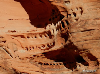
I arrived about an hour before sunset and the sun was casting a warming glow over the landscape. The park's website (link above) tells us that “The Valley of Fire derives its name from red sandstone formations, formed from great shifting sand dunes during the age of dinosaurs, 150 million years ago. Complex uplifting and faulting of the region, followed by extensive erosion, have created the present landscape.”


As you drive around the park, numerous formations jut out above the desert floor.


The formations were piles of swirling rock. It was like Mother Nature had dipped her hand into a bowl of whipped cream and mixed it up to form these incredible rocks.


Wind and rain have added their “artistic touch” to the formations to produce a dazzling display.


Thursday, December 1st - - High winds and rain came through the valley last night. The van was buffeted around quite a bit and if there had been room in the campsite I would have turned the van so that it was facing into the wind. It wouldn't have been quite so bad then. But, from what I've heard, the winds through the Valley of Fire were not nearly as bad as those in California. I've been through a few other bad storms and this compares to some of the worst. I was glad to see the sun come out in the morning, but that didn't last long either.


Rather than stay and be miserable in the wind, rain, and cold air I continued on my drive south.


Friday, December 26, 2014

Frontenac Galaxy


I found another cool tree to photograph against the night sky. The only problem is that it's over 300 miles away from where I live! Located in Frontenac State Park just south of Red Wing, MN, this tree makes a phenomenal foreground for a shot of the night sky. Jessica noticed the tree and pointed it out as we were heading to dinner in Red Wing after setting up our campsite in the park. I made a mental note to stop on the way back and see what it looked like with a star-filled sky above it. As we made our way back to the park after dinner, I found myself getting anxious in anticipation of what the scene would look like. As soon as I saw the stars above and behind the tree I knew I had to photograph it.


It was a bit of a scramble to get beneath the tree as it is situated on top of a rather steep hill on the side of the road as you drive into the state park. Once I made it up the hill and had my camera set up I started making exposures and right away got frustrated by the number of airplanes moving across the sky! Airplanes streaking through your night shots are rarely a problem in northern Minnesota. I had to wait about 5 minutes before there wasn't a single airplane in my shot, then wait anxiously while the 30 second exposure recorded, hoping all the while that another plane would not fly into the shot. After about 10 tries, I finally got one without an airplane :-)

Thursday, December 25, 2014

Life in Longmire

It certainly is snowy here at Longmire. Check out the image of my government issue house. It's almost a snowcave, and those are some serious icicles too. Don't mess with them.

Life is pretty mellow up at Mt. Rainier during the winter. It's great getting out out of Seattle a few days a week to come here. The routine so far has been: hang out in the office (i.e. scheme ways to improve the blog and seek grants for an artist in residence program), go out skiing with climbing ranger Chris Olson (i.e. risk my life following a great skier through steep treed terrain), then hang out at Mike's house (who could be a smashing restaurateur: grilled chops and salmon, mojitos, and lemon drops). Rough life, I know.

Since Chris is pretty much a professional skier and will turn his boards down anything in any conditions, hanging out with him has been an adventure so far. During our first day out a few weeks ago (when the sun last revealed itself), we skied bulletproof ice from Panorama Point to Paradise. The saving grace was crystal clear skies, letting us see almost every big peak in Washington and Oregon. (Right: Chris at Panorama Point).

Once, we skied partway up the Eagle Peak trail then came down in the dark through the trees. It was like being on a roller coaster where you couldn't see the next twist or turn until you came right up on it. Or, as Chris put it in his ski report, it "felt like a bobsled run in the dark." Of course, he wrote that after skiing the trail by himself and blazing down it at about 50 mph. Anyway, we skied it the next day together and came down at a more leisurely pace but it still felt fast to me!

The ski up through the old growth forest was beautiful, with fluffy snow everywhere. Piled in soft pillows all around us, hanging from the trees, falling from the sky. I felt like I was living in a Christmas carol. (Left: Chris leads the way up the "bobsled run")

I was also thinking what a great trail this was for snowshoers, when Chris pointed out how easy it would be to get lost if you didn't know exactly where the trail was. (He was amazed that the trail was still visible through all the recent snow). I realized that he was right and suddenly got a little less complacent about it - especially when he reminded me that a hiker died on this trail last June.

Then again, if anyone knows his way around here, it's probably Chris. The problem is, if you follow him up something, you also have to follow him down.

Wednesday, December 24, 2014

Winter, dry, both or none?


Obviously, the dry tooling route I did on the CIC cascades under the Ben Nevis north face last week was going to provoke a bit of debate. In my mind it’s perfectly suited to climbing in this style and it’s no threat to the traditional Scottish winter routes because it’s so clearly different from them. It did make me wince when I saw UKclimbing.com include a Scottish winter grade in their headline reporting the route. I didn’t give it a Scottish grade for a good reason! I should have seen that coming I guess, although it was hard to foresee that a casual comment by me comparing it to a similar piece of climbing terrain with a winter grade would mean folk would then take this one as a winter route. A bit like saying an E8 trad route has 7c+ climbing - it’s still different from a bolted 7c+! This seemed to fuel a bit of debate about how it related to the traditional winter climbing game. To me, it’s totally clear the route is a tooling route, not a Scottish winter route. Clear and simple.


Some folk argued that maybe it should be left alone in case it dilutes the Scottish winter conditions ethic. I personally don’t agree with this. My feeling is that a one size fits all ethic for anything climbed is unnecessarily simplistic. It’s a shame not to climb that crack just because it doesn’t get rimed up. It’s an excellent climb.


More so than any other climbing discipline, Scottish winter climbing seems to be awful scared of losing what we have. Of course it’s special and worth defending. Perhaps because I like going for the steepest routes I’ve spent more than my fair share of days walking in and turning on my heel because the project is not white enough. It’s natural to resist any changes (even if they are only additions) to the status quo, but not always good. Balanced against the fear of losing what we have must be a fear of losing what we could have. To me, the diversity of British climbing has always been it’s greatest asset. A strict and narrow focus on what can be climbed with tools is a strength in upholding a strong ethic, but a weakness in undermining the diversity of climbs that can be done. I just don’t see that the threat to the Scottish conditions ethic is real. Rather than diminished over the years I have been a climber, I feel it has strengthened. The ethic is so strong, it has room to accept some ‘outliers’. However, that is of course just an opinion of one and may be outweighed by those of others, which is no problem. If other folk thought the tooling route was a good idea, very few have come out and said so.


Winter condition or not? What do you think?


A further interesting twist came when the other new route I wrote about (The Snotter) was questioned for not being in winter condition. I must say that took me seriously by surprise. I’ve done plenty of mixed routes that were on the borderline, but it didn’t enter my head that this one wasn’t in good condition. Simon Richardson wrote a particularly below the belt post on his blog which is here. For some reason he didn’t mention my name in it, and is was a little weird that he wrote such strong words and then reported another new route of mine in the very next post. Anyway, the reason it took me so by surprise was the focus on the section of overhanging wall to get between the ice grooves below and the hanging icicle above. I deliberately went on the route because the recent sunny conditions has been good for helping the grooves below the icicles to become iced. In the 55 metre crux pitch, around 47 metres was climbed on water ice, with 6 metres crossing a grossly overhanging wall underneath the roof to get to the icicle. The 30 metres of grooves below the roof were climbed on ice, initially stepped iced slabby ledges, then a thin ice smeared rib and groove, apart from a few hooks on the right of the ice. Once on the icicle, there was a long section (15 metres at least) before the angle even started to lie back.The downside of this mix of conditions was that the overhanging wall itself was pretty dry. My thinking was that this is par for the course for this type of route. The sun helps more ice form, but at the expense of the rime. My interpretation (which may be ‘wrong’ if such a judgement can truly be made) of Scottish winter conditions is that basically the route must be wintery in appearance. If it was nearly all dry mixed with a little ice, it would be outside that definition and I would have come back another time. But the reality was the pitch was nearly all ice with a short section of dry rock.


A central view in my own new route climbing has always been that I don’t want it to be at the expense of anyone else, even if I don’t agree with their position or motives. Clearly, some folk feel that way. So I have taken away my blog post about the routes and recommend that folk forget about them, if that is what they want to do. They still exist of course, in my memory as great days out and two of the most fun climbs I’ve done in a while. Nothing more ultimately matters. Anyone else is welcome to climb them as first ascents if they feel those ascents are more worthy.


Friday, December 19, 2014

Hovenweep Revisited

Wednesday, May 11th - - My stop for the night was at Hovenweep National Monument, just inside the Utah border, about 45 miles west of Cortez, Colorado.


Yes, I went through Colorado rather quickly. Blame the weather. Call me a wimp if you will, but these extemes in temperatures are not easy to handle. Anyway, I'll be back someday. (I did spend several daysin Coloradolast year at Mesa Verde National Park.)


Earlier in the day, I had checked the weather forecast for several places along my route. The forecast for Hovenweep was quite favorable and I knew from my visit last year that they had a nice campground. The temperature going through Cortez wasn't much better than it had been after going over the San Juan Mountains but as I continued westward it warmed up to a most comfortable 66 degrees.


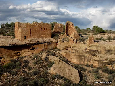
I also spent several days at Hovenweep last year and wrote about the National Monument, The Square Tower Group, and The Holly Group in detail. Since the weather was nice, I walked the two-mile trail around and through the canyon to view the Square Tower Group once again. The sun was playing hide-and-seek with the clouds so I waited for some shots until the sun decided to come out. It wasn't an extremely bright light like it was last year and I'm using a different camera so the pictures have an altogether different feel to them.


The largest structure in the Square Tower Group, which is near the campground, is the Hovenweep House. It includes several outbuildings. Here it is seen from the south side of the canyon.


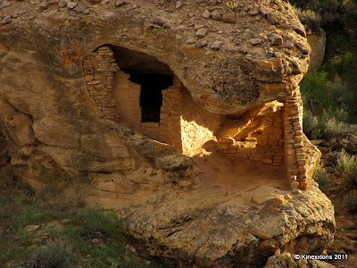
From the north side of the canyon looking at the Twin Towers, Boulder House, and Rim Rock House. Unless you know it's there, it is hard to tell a canyon exists in just a few steps.


A closer look at the Twin Towers, Boulder House, and Rim Rock House.


An even closer look at the Twin Towers (above) and Boulder House (below).


I still find this place to be fascinating, especially how and why these structures were built.


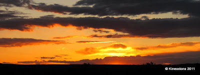
Mother Nature put on another magnificent show at the end of the day.


I've said it before and I'll say it again - sometimes the best sunset pictures are taken looking toward the east (or any direction other than west)! Rain was blowin-in-the-wind and captured the colors of the sun's fading rays.


Tuesday, December 9, 2014

A Wedding Celebration Happy Hour


Buddy is one of our favorite pickleball people. He is pure sunshine and has a permanent smile on his face. He partnered with an equally sweet lady named Diane last year. I didn't really get to know Diane until this year. I could see why he fell for her after I did spend time with her. They are both musical, so they share a common love in that area. She doesn't play pickleball, but she will come down and visit with us when Buddy plays.


They were married during the holidays and we decided to throw them a
celebration party-Pickleball style, meaning with a Happy Hour. Rich and
Donna helped us pull off a great party for them.


Here is the honored couple. Don't they look miserable together?!?


They are so cute together. They walk through the park, hand in hand, with those big grins on their faces. They remind me of what honeymooners look like every time I see them.


Since we have that great shared space, we had tons of room for this party!


Donna got a guest book for people to sign. Vicki and Mira coordinated a huge pot of spaghetti sauce and meatballs and everyone else brought goodies. We had three tables for food for this feast! We were discussing Happy Hour food when going through the line and saying how everything we have ever had at a Happy Hour is great.


We had a great crowd, milling around the fire chatting with each other and giving the couple hugs and happy wishes for their shared life together.


Here is the guest list, copied from Donna's blog:


The Guest List:

Nate and Krystal

Bob and Vicky

Vick and Judy

Rene and Mira

Tom and Karen

Art and Hedy

John and Carla

Earl and Cindy

Garth and Rosemary

Paul and Carla

Woody

Sally

Jim and Patti

Jim and Judy

Nick and Tonya

Rich and Donna


Here is a shot I captured before it was too dark to take pictures and before most of the crowd showed up:


It was a great night. Best wishes Buddy and Diane! We will throw you that baby shower we talked about, if you do end up needing it!


Living the life in friend filled Florida!

What Happens to a Tree

We go to the mountains and cut firewood every fall to use in our wood burning stove over the winter. The first photos show the trees as they look while growing.


The next photos show the tree after it dies. So why does it die? No one really knows why one tree dies and the ones next to it don't. Maybe it didn't get enough water. Maybe to much. Maybe it was struck my lightning or burned in a fire. Or just lived out it's life span. This one was a aspen tree. After it died the upper part fell off.


Then someone comes along and cuts up the part laying on the ground. Rules say you can only get the 'dead and down' wood. The part that was still standing we arn't allowed to take. Many birds and other wildlife could use it.


Then the chunks of wood are loaded into a pickup and brought home.


Here is a photo of the pile of wood after it thrown off the pickup and then we split it with the log splitter, (we are to old for using an ax any more) and afterward it will be stacked in the wood shed so it won't get wet if it should rain or snow. (you can see the woodshed behind the wood pile)


If a piece of wood is very lucky it will not be burned. If it looks like a good piece that can be turned into something pretty on the lathe that is what happens. This piece will be a vase eventually. It was still to green to finish at this point. It will have to dry for a while before being sanded and a finish put on it.


Saturday, December 6, 2014

Crex Meadows Wildlife Area


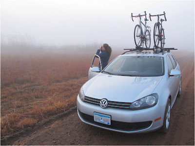
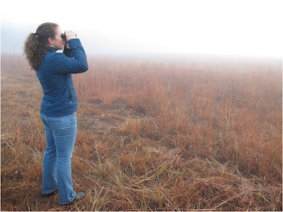
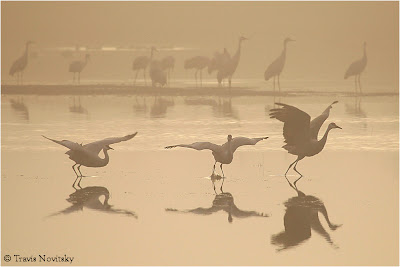
After our bike ride on the Cannon Valley Trail earlier this week, we headed to Crex Meadows WildlifeArea in Grantsburg, Wisconsin.In thefirst two photos shown here Jessica is looking for Sandhill Cranes in the fog during the first light of the day. We could hearalot of cranesin the distance but couldn't see them at first because the fog was so thick.


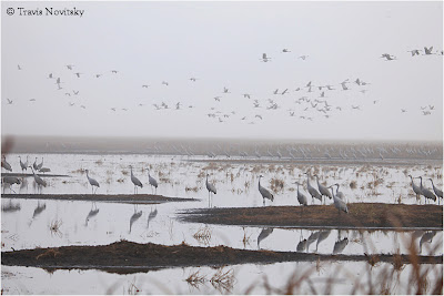
Eventuallly the fog started to clear enough that we were able to start seeing some of the cranes.


Loved this view through the fog of a group of cranes standing on a mud flat.


For about 10 minutes the clouds and fog cleared enough that a bit of sunlight came through and gave us some really cool light. Once the sky cleared a little, the cranes started to take flight.


Sandhill Cranes in the early morning light, diffused by thick fog.


There were several thousand cranes at the refuge, this view along Main Dike Road was where we saw most of them.


These three cranes were walking with purpose across this flowage.


Cranes in flight... love the subtle yet beautiful variation in color on their wings!


We enjoyed a breakfast snack at the "Rest Area" along North Refuge Road. The rest area was surrounded by beautiful oak trees, and looked out over a vast field which included a pond complete with a beaver lodge along the edge of the pond. Every now and then a few cranes would call as they flew overhead. It was a little slice of heaven for us :-)